 Deutsch
 Ελληνικά
 English
 Italiano
 Türkçe
 汉语
汉语


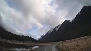
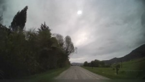
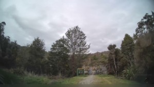
Driving from Whare Creek to Manapouri | Southland | New Zealand | 4K
1,756 views
Categories: Southland Region
Added: 3 years ago
Driving from Whare Creek to Manapouri, in the Southland region, on the South Coast of New Zealand's South Island.
The lakeside town of Manapouri is located at the very edge of the Fiordland National Park and provides a good base for trips into the glacier-carved wilderness. The town was originally called Roto-au (the rainy lake) by early Maori, and then Moturau (many islands). The lake is the second deepest in New Zealand at 444 metres, with a circumference of 170 kilometres. Manapouri is the departure point for Doubtful Sound trips and excursions to the West Arm Power Station, the largest underground power generation in the southern hemisphere. Kayaking on the lake is weather dependent, but a wonderful way to experience the remote bays and sandy beaches.
As New Zealand's ultimate nature and wildlife destination, Southland's dramatic scenery spans pristine rain forests, fertile farmlands and rugged coastlines. With an abundance of hiking trails, cycling routes, fishing spots, classic motors, the world-famous Bluff oyster and the region's iconic cheese roll the region has something for you!
Southland's coastline is 3,400km long; the longest of any region in New Zealand, and one seventh of New Zealand's total. It extends from Fiordland in the west at Awarua Point, around the south coast to the Catlins in the east at Waiparau Head, and includes the coast of Stewart Island/Rakiura and other nearby islands. Southland's coastal waters lie in the Tasman Sea, Foveaux Strait and the Pacific Ocean.
Traveling along Southland's coastline you'll find a mix of flat sandy beaches, rocky outcrops and native forest, all providing an abundance of recreational opportunities.
Comments (0)
Show Comments
-
Driving Hillside Manapouri Road from Lake Manapouri to SH94 | Southland | New Zealand | 4K 1913 views
 11:33
11:33
-
Driving SH95 from Manapouri to Te Anau | Southland | New Zealand | 4K 2394 views
 14:53
14:53
-
Driving around the Cascade Creek DOC Campsite | Southland | New Zealand | 4K 1911 views
 02:02
02:02
-
Driving around the Cascade Creek DOC Campsite 2703 views
 01:05
01:05
-
Driving from the Charming Creek Walkway Start to Seddonville | West Coast | New Zealand | 4K 2170 views
 12:23
12:23
-
Driving around Knobs Flat in the Fiordland National Park | Southland | New Zealand | 4K 2477 views
 01:09
01:09
-
Driving Charming Creek Road from the Mine and Walk Entrance | West Coast | New Zealand | 4K 1596 views
 13:21
13:21
-
Driving Charming Creek Road to the Mine and Walk Entrance | West Coast | New Zealand | 4K 2411 views
 12:15
12:15
-
Driving from Te Anau to Henry Creek DOC Campsite along SH94 | Southland | New Zealand | 4K 1825 views
 06:01
06:01
-
Driving from the Henry Creek DOC Campsite to Lake Mistletoe Carpark | Southland | New Zealand | 4K 2482 views
 01:26
01:26
-
Driving from Upper Eglinton to Cascade Creek DOC Campsite along SH94 | Southland | New Zealand | 4K 1954 views
 02:27
02:27
-
Driving around the Mackay Creek DOC Campsite off SH94 in Fiordland| Southland | New Zealand | 4K 1404 views
 00:58
00:58

© ScenicDrive Productions 2026