 Deutsch
 Ελληνικά
 English
 Italiano
 Türkçe
 汉语
汉语


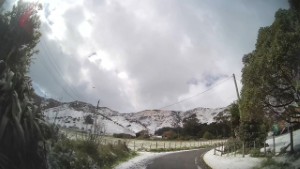
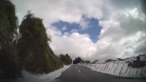
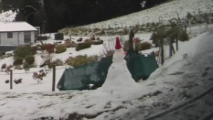
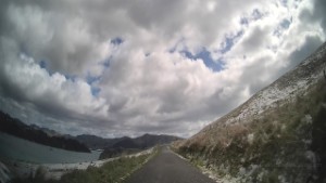
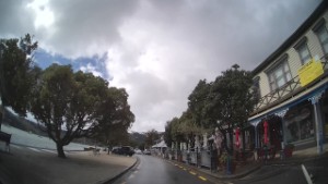
Driving Jetty Road in Port Levy on the Banks Peninsula | Canterbury | New Zealand | 4K
2,371 views
Categories: Canterbury Region
Added: 2 years ago
Driving a snow covered Jetty Road in Port Levy on the Banks Peninsula, in the Canterbury region on the East Coast of New Zealand's South Island.
Port Levy is a small settlement on the north side of Banks Peninsula. It sits on the west side of a long narrow inlet with the same name. Near the head of the inlet is a wharf popular for boating and fishing.
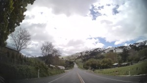
The Banks Peninsula is located in the Canterbury region on the East Coast of New Zealand's South Island. The peninsula is a mass of volcanic hills, covering an area of 1,165 sq km. They stick out from Canterbury's coastline from the Canterbury Bight to Pegasus Bay. The highest point is Mt Herbert (Te Ahu Patiki), at 920 m, and overlooks Lyttelton Harbour. The height is below half the size of the volcanoes before their extinction.
Hilly terrain, wetter climate, and history o forest clearance make Banks Peninsula more like parts of the North Island. Farming is popular in the hills, but tourism now has more economic importance. One of the first products exported from Banks Peninsula (to Australia) was Cheese. A small cheese factory remains at Barrys Bay. Akaroa is the principal town. Steep, narrow roads connect other small settlements.
Port Levy is a small settlement on the north side of Banks Peninsula. It sits on the west side of a long narrow inlet with the same name. Near the head of the inlet is a wharf popular for boating and fishing.
The Banks Peninsula is located in the Canterbury region on the East Coast of New Zealand's South Island. The peninsula is a mass of volcanic hills, covering an area of 1,165 sq km. They stick out from Canterbury's coastline from the Canterbury Bight to Pegasus Bay. The highest point is Mt Herbert (Te Ahu Patiki), at 920 m, and overlooks Lyttelton Harbour. The height is below half the size of the volcanoes before their extinction.
Hilly terrain, wetter climate, and history o forest clearance make Banks Peninsula more like parts of the North Island. Farming is popular in the hills, but tourism now has more economic importance. One of the first products exported from Banks Peninsula (to Australia) was Cheese. A small cheese factory remains at Barrys Bay. Akaroa is the principal town. Steep, narrow roads connect other small settlements.
Comments (0)
Show Comments
-
Driving Puari Road in Port Levy on the Banks Peninsula | Canterbury | New Zealand | 4K 2105 views
 00:48
00:48
-
Driving from Port Levy to Purau on the Banks Peninsula | Canterbury | New Zealand | 4K 2330 views
 12:54
12:54
-
Driving Pa Road in Port Levy on the Banks Peninsula | Canterbury | New Zealand | 4K 2167 views
 03:37
03:37
-
Driving Fernlea Point Road in Port Levy on the Banks Peninsula | Canterbury | New Zealand | 4K 1877 views
 01:40
01:40
-
Driving from Purau to Port Levy on the Banks Peninsula | Canterbury | New Zealand | 4K 2643 views
 13:46
13:46
-
Driving Puari Road in Port Levy on the Banks Peninsula | Canterbury | New Zealand | 4K 1916 views
 00:52
00:52
-
Driving from Diamond Harbour to Purau on the Banks Peninsula | Canterbury | New Zealand | 4K 2476 views
 04:27
04:27
-
Driving from Purau to Diamond Harbour on the Banks Peninsula | Canterbury | New Zealand | 4K 1910 views
 06:21
06:21
-
Driving Camp Bay Road from Purau | Canterbury | New Zealand | 4K 2431 views
 03:04
03:04
-
Driving Beach Road in Akaroa next to the harbour | Canterbury | New Zealand | 4K 1754 views
 04:11
04:11
-
Driving Jetty Street in Kingston near Queenstown at the foot of Lake Wakatipu | 4K 2307 views
 08:54
08:54
-
Driving SH75 from Akaroa to Takamatua | Canterbury | New Zealand | 4K 2162 views
 03:53
03:53

© ScenicDrive Productions 2026